Pt. Reyes National Seashore reports
Fissures Near the Chimney Rock Trail
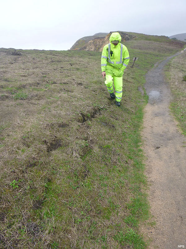
Cracks were reported on a portion of the bluff near the Chimney Rock Trail on December 21, 2015. These fissures could indicate the possibility of a weakening cliff face in the area. The land may be unstable and a collapse or erosion could occur. Visitors are reminded to stay on designated trails.Bluffs along the California coast are inherently unstable. They are prone to crumbling and sliding, especially in wet weather. It is very dangerous to climb or walk along the edge of cliffs. Be aware of falling rocks if walking near the base of a rock face.
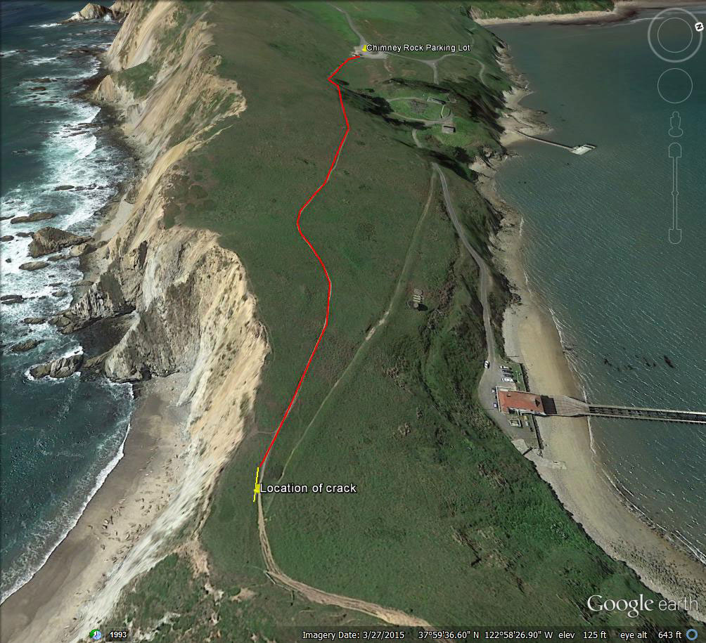
View: Close-up photograph of the fissure. (172 KB jpg) Photograph of the area with the fissure from the southeast. (117 KB jpg) Aerial photograph of the location of the fissure marked in yellow. (216 KB jpg)
Click read more to read an excerpt from email by Pt. Reyes National Park Superintendent
Head’s up! Brady Greene and Mike Wasielewski from the Trail Crew have discovered a fresh crack system along the Chimney Rock Trail. The crack is about 600 meters from the Chimney Rock parking lot. Attached are images and maps provided by Brady and Mike.
We have conferred with the NPS Geohazards Specialist (who also assessed the Arch Rock Collapse) and his analysis concluded that, “It is impossible to predict if this particular section of cliff will collapse tomorrow or in decades. The fresh crack system may indicate a more imminent event or the bluff section may have settled and is now in another period of quasi-stability. Caution combined with monitoring and continuing assessment seems like an appropriate response.”
On this recommendation, we are taking the following actions immediately:
- notify all employees
- notify visitors via social media, the park website, and signage
- monitor the crack (currently ~14 m long and “10 cm deep) for any changes (mainly spreading) that would indicate further precautions and assessment are needed. We will keep staff updated on the results of this monitoring.
In response to the Arch Rock Collapse last spring, we asked USGS to create a coastal collapse risk map for PORE that will provide an estimate of coastal collapse rates along our coastline. USGS has been making field measurements over the past few months and we anticipate a report and map this spring. The resulting risk map will provide insight into safely managing both visitor access and employee safety.
As we all know, there is inherent instability in California’s coastal bluffs. If you see similar cracks, please notify park management or the safety committee immediately.
Also, please look out for your own safety! Be aware of this potential hazard when you are in the area and keep your situational awareness high whenever you are on or below the coastal bluffs. Last March at Arch Rock, we experienced firsthand how suddenly a failure along the coast can occur, and how tragic that outcome can be


Leave a comment